
Best Motorcycle Roads in Norway: Trollstigen, the Lysevegen, and Beyond
Norway’s roads aren’t the most famous in Europe. They should be. Trollstigen, the Lysevegen, Sognefjellet — these are passes that change what a rider thinks is possible on two wheels.
Most motorcyclists who come to Norway arrive with one road in mind: Trollstigen. The eleven switchbacks, the waterfall running alongside the road, the reputation. It earns that reputation. But Trollstigen is not even the best road in the county where it sits, let alone in Norway, and riders who plan a trip around it alone leave having missed several roads that are, in important ways, more interesting. This guide covers the roads that make Norway worth a dedicated trip — the ones the riding forums argue over, and the ones that have no forum presence at all because too few riders have found them.
The routes are loosely organized south to north across western Norway, which is where the fjords and the passes concentrate. Eastern Norway has scenery and reasonable roads; western Norway has roads that have no equivalent elsewhere in Europe. The focus here is on the west.
Trollstigen — The One Everyone Knows
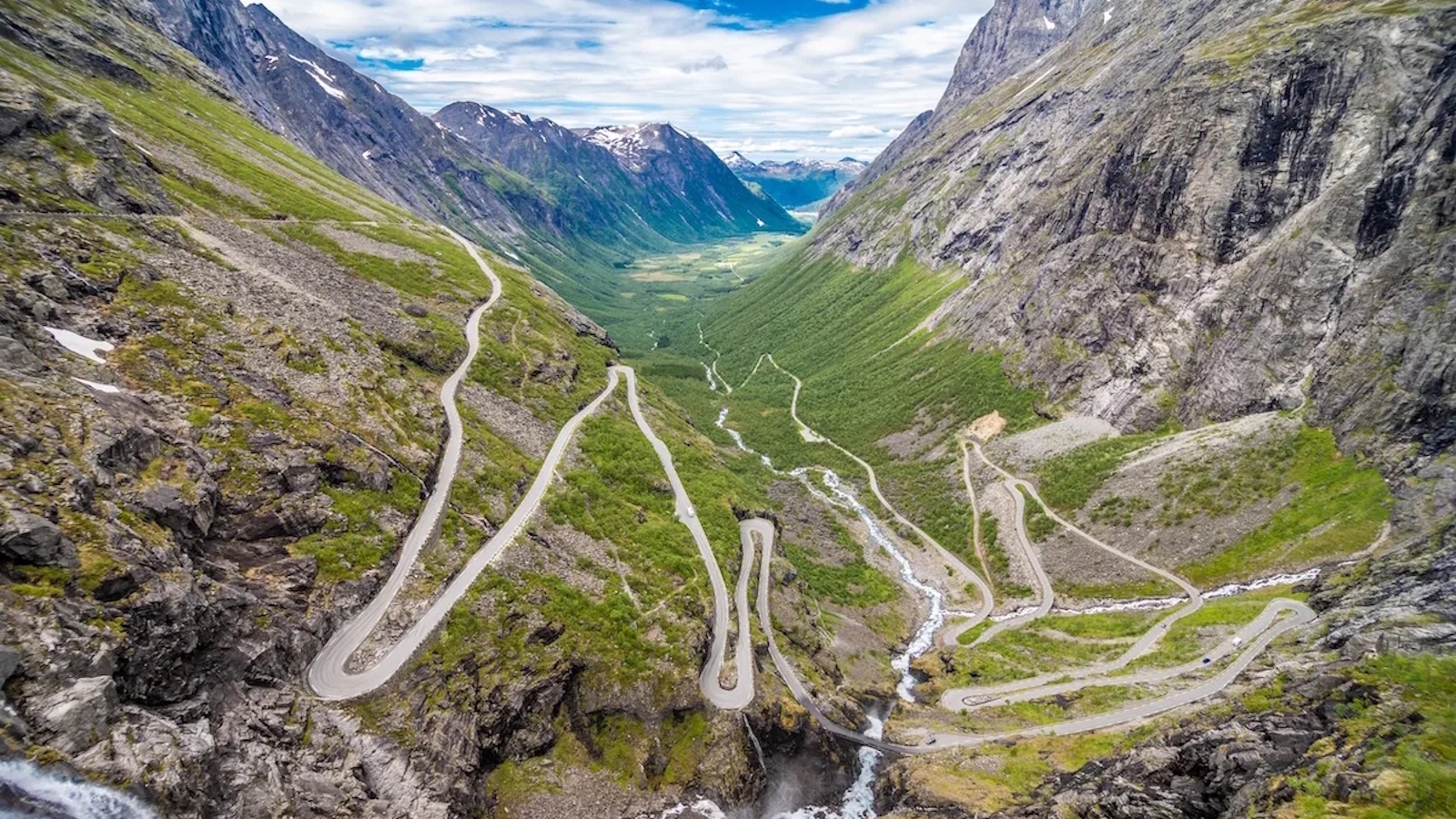
Start here, because every Norway motorcycle guide starts here, and because ignoring it would be dishonest. The Trollstigen — the Troll’s Ladder — climbs 850 meters in 11 hairpins, with the Stigfossen waterfall dropping 320 meters alongside the road for most of the ascent. The numbers are correct. The experience of riding it, with the mist from the waterfall drifting across the tarmac and the valley floor visible through the barriers on the outside of each corner, is something the numbers don’t prepare you for.
Riders who know the Stelvio will recognize the structure immediately: a famous hairpin climb with a reputation, a waterfall, numbered corners, and enough traffic by midday to make the morning run feel like a different road. The comparison holds up — but Trollstigen is tighter, shorter, and more enclosed than the Stelvio. Where the Stelvio offers long sightlines across an open Alpine face, Trollstigen wraps you in rock and spray. The Stelvio has sky; Trollstigen has cliff. Both reward an early start for the same reason: the road earns its reputation before the coaches arrive.
The practical advice: ride it early. The Trollstigen opens each spring and attracts enormous summer traffic — tour buses, camper vans, cyclists, and a steady stream of motorcycles from every country in Europe. On a weekday morning before 9 a.m., or in September after the peak season, it is a different road. The road surface is good; the corners are tighter than they look in photos; the gradient on the steepest section approaches 10%. In a light motorcycle, that gradient matters on the way up. It matters more on the way down.
The Trollstigen is a national scenic route in both directions. The northern approach from Åndalsnes follows the Rauma valley — a long, broad valley with the Romsdalshorn massif overhead and a river alongside the road. The southern approach from Valldal is slower and more varied. Both are worth riding. If you have time for only one approach, ride up from the south.
The Romsdalseggen Ridge Road and the Rauma Valley
The Rauma valley, which feeds into the Trollstigen approach from the north, is one of Norway’s designated National Scenic Routes — a designation the Norwegian government gives to roads with exceptional landscape value, and which in this case is an understatement. The valley floor road runs alongside the Rauma river from Åndalsnes toward Bjorli, with sheer rock faces several hundred meters high on both sides and, in season, waterfalls dropping directly onto the road margin from the valley walls above.
The road is not technical. It doesn’t need to be. Riding the Rauma valley is about the scale of the landscape — the kind of riding where you slow down not because the corners demand it but because slowing down is the correct response to what is around you. The Rauma valley and the Trollstigen together form a natural loop from Åndalsnes, and riders who spend two nights in Åndalsnes and use a day on that loop leave with a good understanding of what Norwegian riding actually is.
Sognefjellet — Northern Europe’s Highest Pass
The Sognefjellet road (National Scenic Route 55) crosses northern Europe’s highest mountain pass at 1,434 meters, connecting Lom in the east to the Sognefjord in the west. The scale is different from the Trollstigen — less dramatic in a single-frame sense, more sustained. The road climbs out of the treeline into an open alpine plateau where snow patches persist into July, the views extend for 60 kilometers in clear weather, and the stone cairns alongside the road mark the path that walkers and packhorses used before anyone bothered to pave it.
The western descent is the better direction. From the summit plateau, the road drops toward the Sognefjord in a series of broad sweepers with the fjord appearing far below and growing larger with each kilometer. The gradient is gentler than Trollstigen, the road wider, and the riding rhythm is closer to alpine touring than hairpin technique. At the bottom, the village of Skjolden sits at the innermost point of the Lustrafjord — a branch of the Sognefjord — and the contrast between the barren summit plateau and the deep blue water at the foot of the descent is the kind of thing riders reference when they try to explain why Norway is different from anywhere else they’ve ridden.
Stegastein — The Viewpoint Road Above Aurlandsfjord
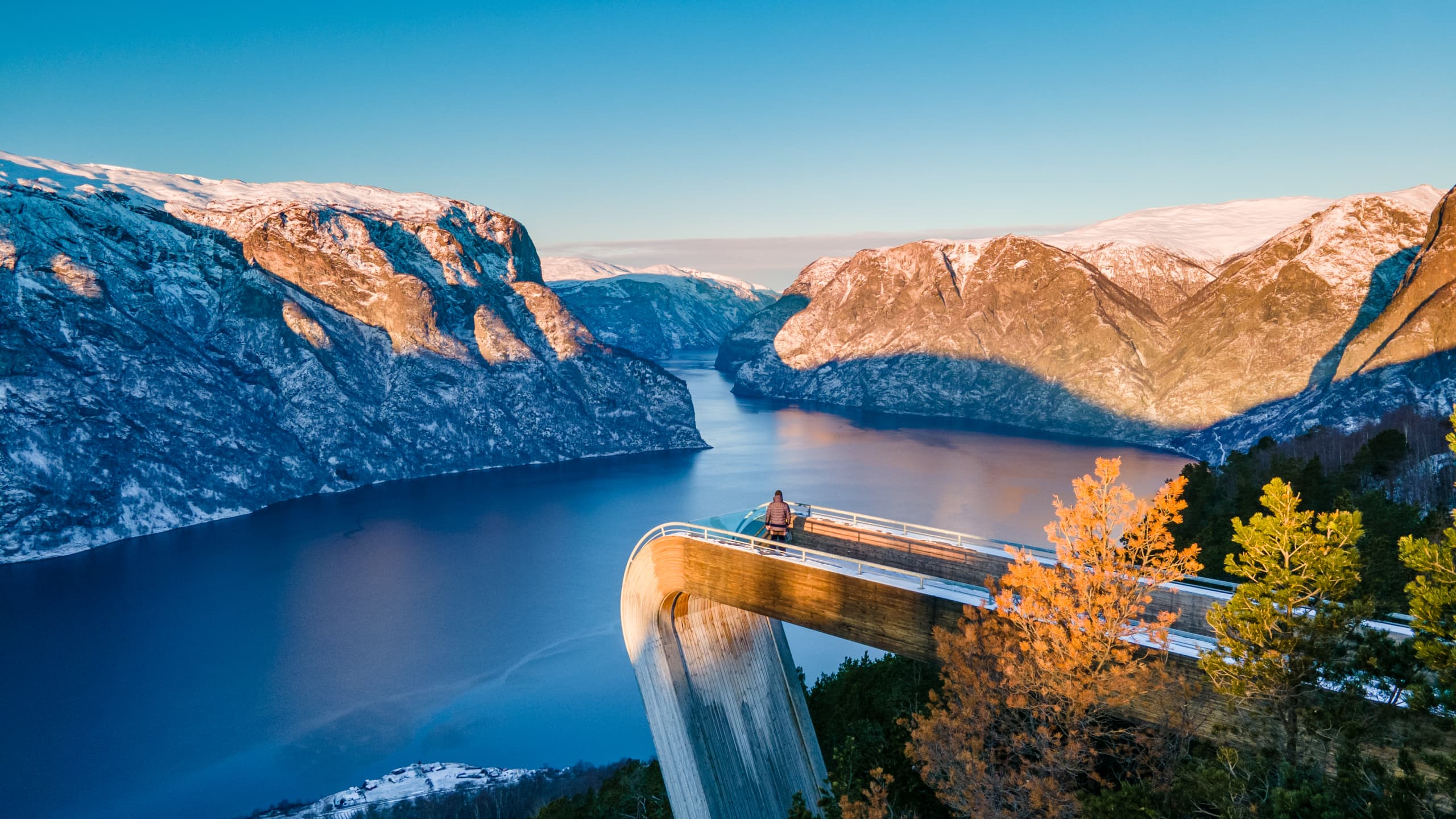
The road to the Stegastein viewpoint descends from the Sognefjellet plateau toward Aurland, with the Aurlandsfjord visible from the first kilometer of the descent and growing closer and more detailed as the road winds down through increasingly tight hairpins. The Stegastein viewpoint itself — a cantilevered platform extending over the fjord 650 meters below — is the destination for the tour buses. The road to it is the destination for the riders.
The descent from Sognefjellet to Aurland covers about 20 kilometers and drops nearly 800 meters. The road surface is good throughout. The corners are consistent — not the random variation of a road that grew from a track, but a road that was designed for the gradient and planned around the switchbacks. At the bottom, Aurland is a small fjord village with ferry connections across the Sognefjord and, if you’re continuing south, access to the Nærøyfjord road, which is narrower, older, and less traveled than anything on this list.
The Lysevegen — 27 Hairpins and a U-Turn Underground
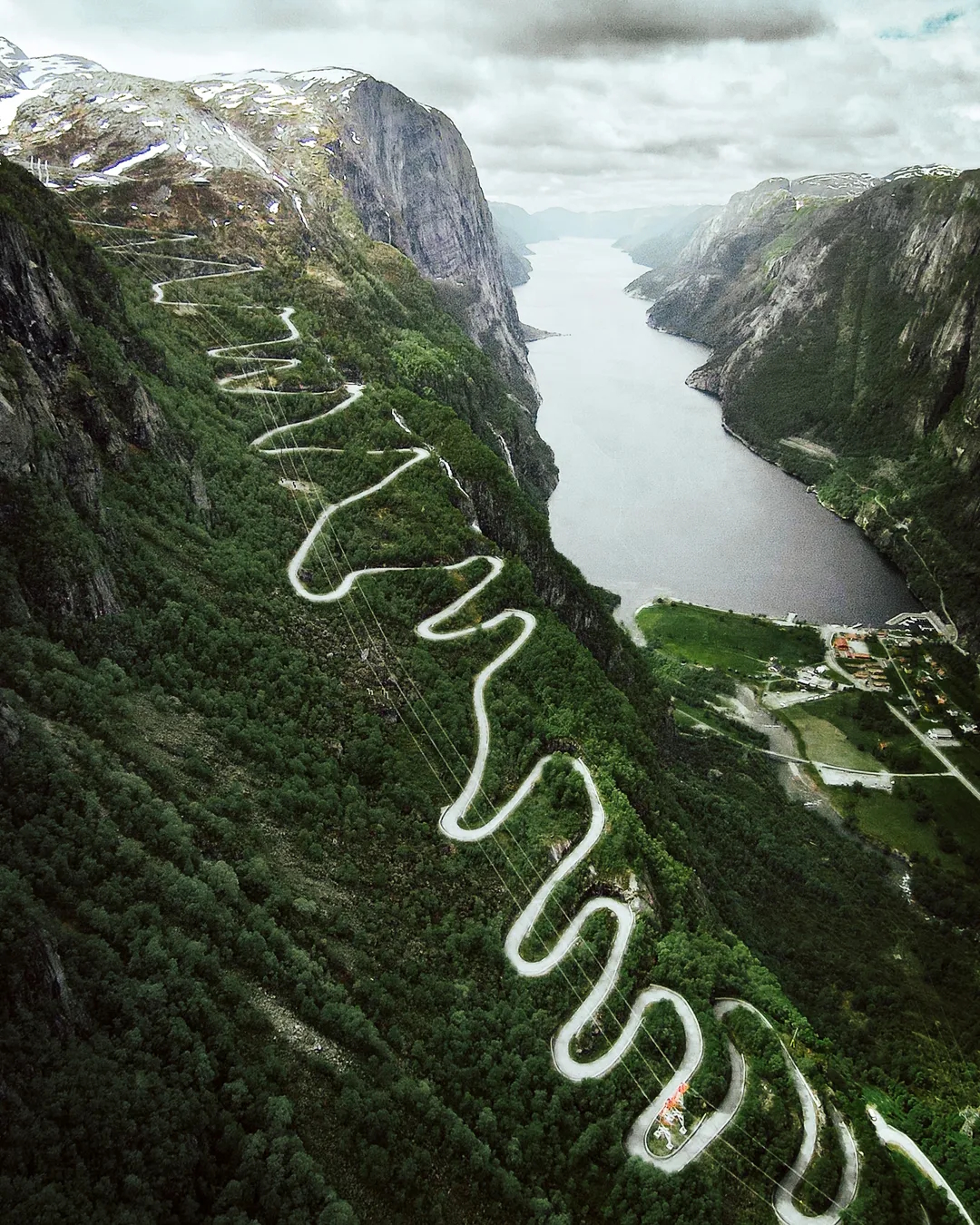
The Lysevegen is the road that Norwegian riders describe when they want to end an argument about which road in Norway is the most extreme. The road climbs 900 meters from the Lysefjord at Lysebotn to the plateau above in 27 hairpins — numbered, so you know exactly where you are in the sequence — plus a U-shaped tunnel near the top that doubles back on itself inside the mountain. The gradient on some sections exceeds 12%. The outside of several hairpins has no barrier. The road was built to service the hydroelectric infrastructure above the fjord and was not designed with touring motorcycles in mind.
The access from the fjord requires a ferry from Forsand or Lauvvik — a 2-hour passage up the Lysefjord with the Preikestolen cliff (the famous Pulpit Rock) visible above the water on the northern wall. The ferry is part of the experience; riders who skip it and approach from the plateau above miss the full context of the road. The Lysevegen from the fjord floor, knowing what 27 hairpins up a 900-meter rock face means before you start, is a different proposition from arriving at the top and looking down.
The road surface at the bottom is rougher than the roads higher up — a consequence of the near-constant moisture from the fjord. By the fifth hairpin it improves. By the fifteenth, it is excellent. The view from the top, over the Lysefjord and south toward Stavanger, is the best road-accessible view in southern Norway.
The Island Roads — Bridges, Ferries, and the Atlantic Ocean Road
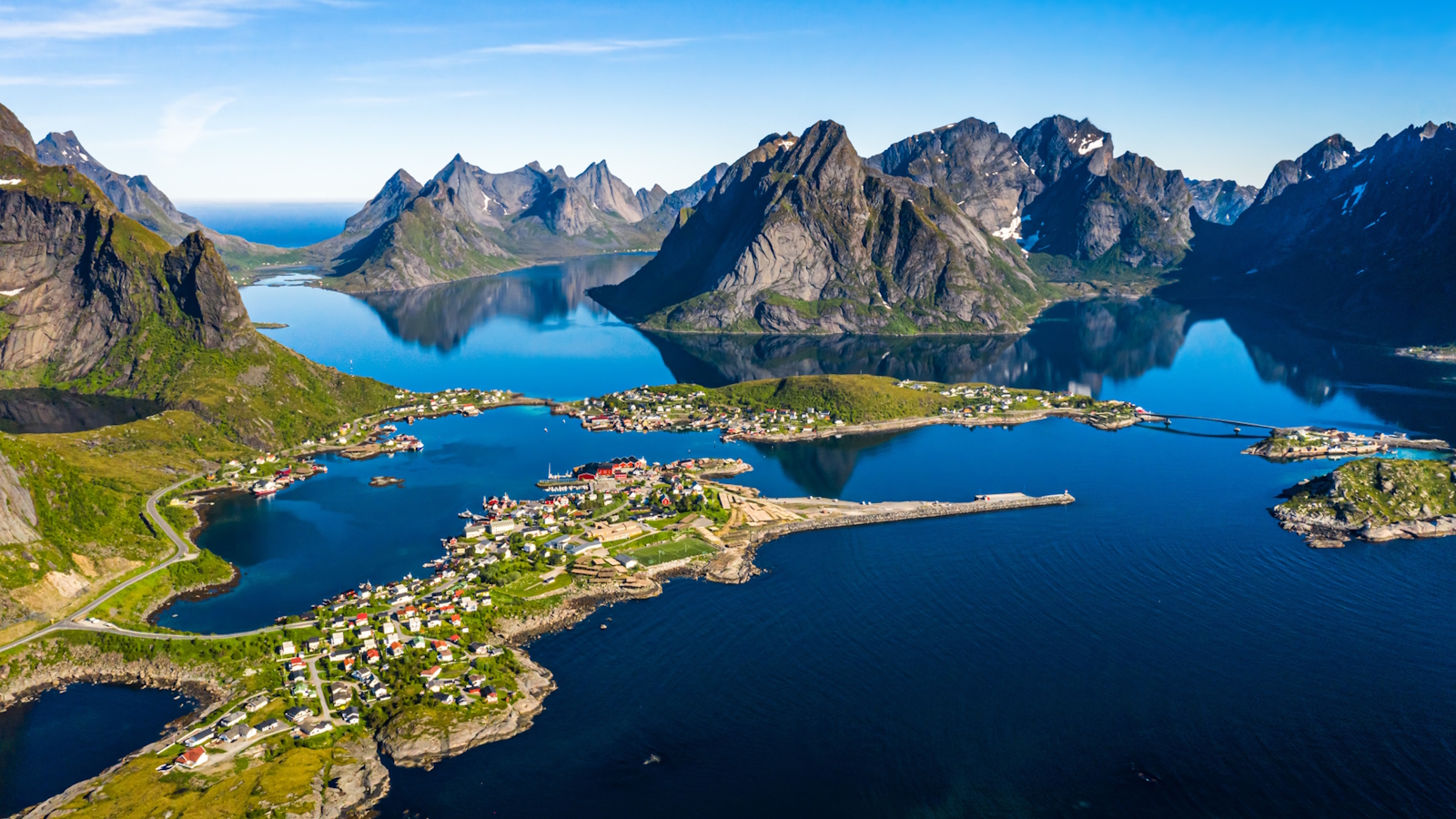
Western Norway’s coastline is not a continuous shore. It fragments into islands, peninsulas, and fjord inlets, connected by bridges, undersea tunnels, and ferries. The riding between Ålesund and Stavanger involves more transitions between land and water than any comparable route in Europe, and those transitions are part of what makes it unusual.
The Atlantic Ocean Road (Atlanterhavsvegen) north of Molde is the most photographed stretch — a series of causeways and low bridges crossing islets and open water, with the Atlantic visible in both directions on clear days. It is not a technical road. The interest is entirely in the setting: riding across the Atlantic, with the ocean on both sides and nothing between you and the horizon. It is the right kind of strange.
Further south, the island-hopping between Bergen and Stavanger uses a mix of modern bridges and older ferry crossings that have no equivalent in mainland Europe. The ferries — short crossings of 10 to 30 minutes — are not obstacles. They are places to stop, drink coffee, and watch the fjord from the deck. After several days of concentrated riding, they provide exactly the right amount of pause.
Practical Notes for Motorcycle Riders
Season. The key passes — Trollstigen, Sognefjellet — open in late May or early June and close in October, subject to snowfall. July and August are peak season; the roads are busiest but the weather is most reliable. Early September offers lighter traffic with good odds of dry weather. Late May has the passes open but can produce cold, wet days at altitude.
Road surfaces. Norwegian roads vary more than their reputation suggests. The national scenic routes are well-maintained and generally excellent. Secondary roads serving farms and small communities can be rough, especially on sections that see frost damage in spring. The Lysevegen lower section is the roughest road on this list; everything else is good to excellent.
Fuel. Norway has good fuel coverage on main routes. On the passes and island roads between major towns, gaps of 60 to 80 kilometers without a station are common. Plan accordingly; don’t leave a fuel stop assuming the next one is 20 kilometers away without checking.
Ferries. Several key routes require ferry crossings. Schedules are reliable but not unlimited — a crossing every 30 to 45 minutes is typical; some routes run hourly. Build ferry time into your day, especially if you’re on a schedule. Cash is not required; card payment is standard on all Norwegian ferries.
Weather. Western Norway is wet. Bergen averages 240 days of rain per year. The fjord region generates its own weather, and conditions on the passes can change in an hour. Pack for rain regardless of the forecast. The payoff when the weather clears — which it does, reliably, between fronts — is a road system that is visibly cleaner, greener, and more vivid than anywhere you’ve ridden in drier conditions.
Ride Norway with Blue Strada
Trollstigen, Sognefjellet, the Lysevegen, Bergen, Stavanger — 1,700 km across southern Norway’s finest roads, with an English-speaking tour leader, your motorcycle included, and all accommodation and dinners covered.
View the Norwegian Fjords Motorcycle Tour →
No Responses